Log in
All resources
Create a design
11,660 Free Images of Old Map
maps by willem and johannes blaeu
atlas du canton de paris, 1795
maps of paris from the david rumsey historical map collection
composite map
atlas novus (blaeu)
emanuel bowen
bibliothèque nationale de france
baroque
maps by emanuel bowen
french-language maps of spain
maps of kodagu district
old maps of india
old maps of the eastern hemisphere
1710s maps of the world
old maps of somaliland
zeila
fort victoria (moluccas)
johannes nessel
17th-century maps of denmark
old maps of seas
1850s maps of the americas
maps by john tallis
maps by willem and johannes blaeu
old maps of enkhuizen
maps by willem and johannes blaeu
old maps of gouda
maps of paris from the david rumsey historical map collection
atlas du canton de paris, 1795
maps of paris from the david rumsey historical map collection
atlas du canton de paris, 1795
maps of paris from the david rumsey historical map collection
atlas du canton de paris, 1795
maps of paris from the david rumsey historical map collection
atlas du canton de paris, 1795
maps of paris from the david rumsey historical map collection
atlas du canton de paris, 1795
maps of paris from the david rumsey historical map collection
atlas du canton de paris, 1795
maps by jacques-nicolas bellin
old maps of new france
voyages and travels to india, ceylon, the red sea, abyssinia, and egypt, vol. 2
henry cooper (engraver)
maps in the library of congress
1670 maps
17th-century maps of zeeland
old maps of south holland
munich in the 17th century
baroque
pieter schenk (ii)
old maps of saxony
old maps of cities in texas
1892 in waco, texas
war of jenkins' ear
edward vernon
maps of paris from bibliothèque nationale de france
battle of saint-denis (1567)
maps of paris from bibliothèque nationale de france
battle of saint-denis (1567)
old maps of norwich
james basire
locator maps of the harbour of rotterdam
zalmhaven (rotterdam)
maps of cefala by braun & hogenberg
national museum of tanzania
maps of mecklenburg-schwerin
old maps of mecklenburg
maps made in the 17th century
old maps of overijssel
old maps of constantinople
emery walker
maps of paris from paris musées
maps of paris by jean lattré
maps by willem and johannes blaeu
old maps of roermond
old maps of osnabrück
coats of arms on maps
maps by willem and johannes blaeu
atlas van loon
maps by willem and johannes blaeu
old maps of dokkum
maps by willem and johannes blaeu
old maps of alkmaar
maps by willem and johannes blaeu
old maps of nijmegen
map of brugse vrije by pieter claeissens de jonge
pieter claeissens
maps by willem and johannes blaeu
old maps of gironde
guide joanne espagne et portugal-1906
french-language maps of spain
maps by willem and johannes blaeu
maps of steenwijk
general atlas (1773)
old maps of sakhalin
1830s maps of switzerland
1834 maps of europe
parts of old maps of hamburg
maps of hamburg-altstadt
nouvelle géographie universelle, vol. xii
charles eugène perron
maps from the earth and its inhabitants, vol. xii
africa in the 1890s
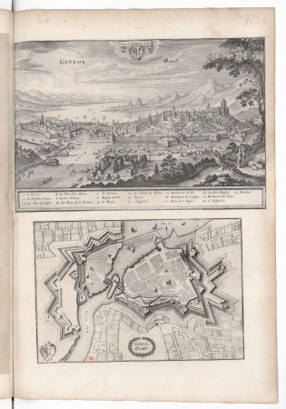
old maps of geneva
baroque
lutetia parisiorum urbs, toto orbe celeberrima notissimaque caput regni franciæ by sebastian münster
maps of paris from bibliothèque nationale de france
midden-delfland in the 18th century
maps of midden-delfland
maps by willem and johannes blaeu
old maps of vlaardingen
old maps of baghdad
matrakçı nasuh
18th-century maps of greenland
old maps of the arctic
maps of paris from paris musées
dheulland map of paris
lordship of mechelen
1645 maps of belgium
old maps of trinidad and tobago
animals on maps
eran laor cartographic collection
john cary
topographia westphaliae (merian)
baroque
cross of trier in heraldry
coats of arms on maps
maps by willem and johannes blaeu
old maps of zierikzee
maps by willem and johannes blaeu
1665 maps
breda, netherlands in the 17th century
old maps of north brabant
17th-century maps of slovenia
17th-century maps of istria
maps by emanuel bowen
britannia depicta
old maps of manhattan, new york city
1851 maps
old submaps of paris 5e arrondissement
porte saint-victor (paris)
maps from the mechanical curator collection available to georeference
maps from the mechanical curator collection
guide joanne espagne et portugal-1915
1915 maps
maps from the mechanical curator collection available to georeference
maps from the mechanical curator collection
historical images of rapperswil-jona
topographischer atlas der schweiz
maps from the earth and its inhabitants, vol. xi
africa in the 1890s
maps by pieter mortier
old maps of asia
maps with cartouches
old maps of fujian
18th-century maps of berkshire
britannia depicta
maps in the national archives of sweden
erik dahlbergh
maps by jodocus hondius
old maps of the guianas
maps of castile by mercator-hondius
flandria illustrata
old maps of lille
1801 maps of germany
maps by john cary
old kievan fortress
old maps of kyiv
hendrik van langren map of south asia
1590s maps of cyprus
hamburgische elbkarte von melchior lorichs
maps of hamburg-moorburg
guide joanne normandie-1912
1912 maps of france
norman heathcote
maps of st kilda
guide joanne espagne et portugal-1915
1915 maps
avenionensis ditio et venaisinus comitatus (galleria delle carte geografiche)
old maps of avignon
maps by willem and johannes blaeu
old maps of axel
medieval louvre
baroque
carte de la mer mediterranée (1764) by roux
eran laor cartographic collection
old maps of koedijk
old maps of alkmaar
maps of valenciennes city walls
old maps of valenciennes
maps in the british museum
jan claesz ten hoorn
1747 persia map by emanuel bowen
1740s maps of georgia
16th-century maps of southeast asia
maps by girolamo porro
siege of steenwijk 1592
maps of steenwijk
guide joanne espagne et portugal-1915
1915 maps
topographischer atlas der schweiz
old maps of zollikon
maps by willem and johannes blaeu
old maps of stavoren
maps by emanuel bowen
old maps of peru
18th-century maps of western europe
jean étienne guettard
turgot map of paris – derivative files
château de la tournelle (paris)
7401 - 7500 of 11,660
Next page
/ 117


![Manatvs located on the Noot [sic] Riuier., 1639](https://cdn.creazilla.com/illustrations/10001304673/manatvs-located-on-the-noot-sic-riuier-1639-md.jpg)